The historical time of the formation of Can Tho land was opened and present on the map of Vietnam since 1739, with the name Tran Giang. If further, this land appeared and existed during the formation of the Mekong Delta from BC. On February 23, 1876, after taking over the entire southern province of the province, the French colonialists decided to take the decree of Phong Phu (Tran Giang) and a part of An Xuyen and Tan Thanh districts of An Giang province (King's time). Minh Mang) to establish Can Tho county.
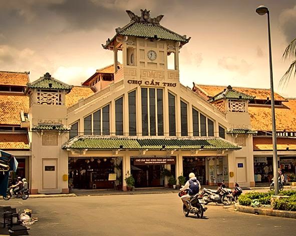
Artwork (Source: Internet)
I. THE PUBLIC HEALTH IN THE MINISTRY OF THE MOUNTAIN - CUU LONG RIVER, AND THE FORMATION OF THE DEPARTMENT OF TRAN GIANG:
In the thirteenth century, Chau Dat Quang, when sailing along the seaport to Tien River, in the South-West direction, to Ang Co, was recorded in the book "Chan Lap windbreak" to say about the Mekong Delta as follows: “Looking at the shore, we see all the tall and ancient rattan trees, golden sand, white reeds, transient not easy to know the entrance. So sailors thought it was difficult to find the right estuary. By the end of the XVIII century, when miệt on Đồng Nai - Sài Gòn had villages, the administrative apparatus that governed the district government was officially established from 1698, then this whole area from the seaport is still " thousands of stomped forests ”.
In the wild space of the Southern lands, until the sixteenth and seventeenth centuries, the people-in-group were drawn to open up, opening a new historical process with a different cultural model. In that process, the ancient Can Tho was the "concave" land that was not only partly exploited late than in Dong Nai - Saigon but also with the poor (Ha Tien). At the end of the 17th century, Mr. Mac Cuu was Chau Loi, Guangdong Province - China did not submit to the Qing Dynasty and many entourage and people followed the straight sea route to Ha Tien, close to Chan Lap (Cambodia) region. new land, mining and career development. Mr. “Recruiting villagers to go to Ha Tien, Phu Quoc, Lung Ky, Can Bot, Vung Thom, Rach Gia, Ca Mau to make 7 villages…”. At first Mr. Mac Cuu asked to submit to the kingdom of Chan Lap, but later was repeatedly attacked by Siamese soldiers that Chan Lap court was unable to protect, so he decided to send his subordinate Truong Cau and Ly Xa to submit a confession to Phu Xuan capital, offering seven communes. My village explored for Lord Nguyen. In the autumn of August of the year of Mau Ty (1708), Lord Nguyen Phuoc Chu ordained Mr. Mac Cuu to be General of Ha Tien. Mr. Mac Cuu established a fortress in Phuong Thanh, the people gathered more and more. In 1732, the entire southern land was divided by the Nguyen Lord to make 3 palaces and 1 Tran. They are Tran Bien Dinh (Bien Hoa area), Phien Tran Dinh (Gia Dinh area), Long Ho Dinh (Vinh Long area) and Tran Ha Tien.In 1735, the Governor-General Mac Cuu died. His son, Mac Thien Tich (formerly known as Mac Thien Tu) was ordained a prefect of his father. From Ha Tien, he promoted the opening of the right bank of Hau river. In 1739,
The Governor-General Mac Thien Tich found Tran Giang to have a strategic position to serve as a post-burial official for Ha Tien against the Siamese and Chan Lap troops frequently invading and harassing. So, before that Mac Cuu had opened up Ha Tien land, then Mr. Mac Thien Tich also built Tran Giang like that in all aspects: military, economic, commercial and cultural.
The great god Nguyen Cu Trinh was sent to South Vietnam by Lord Vo Vuong Nguyen Phuc Kho in 1753, and met with the Governor of the Province Mac Thien Tich and was very sympathetic to his strategy. The two talents discussed and agreed on each other in Tran Giang construction plan. Tran Giang has since developed and become a strong "headquarter" in Hau Giang region.
The book of Gia Dinh became a common reference when writing about the Hau River in the past, mentioning Tran Giang Headquarters, located on the west bank of the upper Hau River from the east of Nam Vang Citadel, flowing to Chau Doc and Can Dang. Lap Vo mountain, then Tran Giang, passing Tran Di religion, going out to Ba Tham sea ... ”
At the beginning of 1755, Dai Than Nguyen Cu Trinh, who was in charge of the good doctor of Binh Khang, Binh Thuan, Tran Bien, Phien Tran and Long Ho (from Phu Khanh to Vinh Long today) helped Mr. Thien to take care of the stabilization. On the southwestern border, An Nguyen (the ancient Cambodian King) relied on Siamese soldiers to return to the Con Man people (Cham people living in Cambodia) and harass the border of our country. After Nguyen Cu Trinh brought troops to rescue the Con Man people and settled them in Ba Den Mountain (Tay Ninh), then, Lord Nguyen and the generals intended to take troops to ask Trinh Nguyen. Nguyen Nguyen realized that the Nguyen army's position ran through Ha Tien, thanks to Ha Tien, Mac Thien Tich, as an intermediary to reset the relationship. Mac Thien Tich wrote up his words, but Lord Nguyen disagreed because for Nguyen Nguyen to be the one who took the bait and lies. Nguyen Cu Trinh offers to God: "From the past, it was only to use troops to eradicate good people, to expand the realm. Nay Nguyen Nguyen apologized and paid tribute to peace. If they keep going on that lie, they will run away. Besides, from Gia Dinh fortress to La Bich, the roads were far away, thousands of forests were scattered, not convenient to chase to (...) spending by entrusting the gods to consider, look at the form, accumulate contributions, divide the field level. land for the people to cultivate and mark the border clearly ”.
The vow of the great god Nguyen Cu Trinh approved by the Lord, has opened an important strategic direction for the reclamation of a career on the "concave" land of Tam Phong Long (this deserted Bassac region). Nguyen Cu Trinh moved Long Ho palace from Cai Be across the Tien River (present-day Vinh Long province); taking Sa Dec land to put Dong Khau and Cu Lao land in Tien river to lead Tan Chau, Chau Doc in Hau river to set Chau Doc religion and bring troops at Long Ho palace to defend the vital places where the beginning is significant. is a military zone, both military and defense function, has assumed administrative functions - ruled over the military regime, belonging to Long Ho palace - a military and administrative unit of the Central State. The three Dong Khau, Tan Chau and Chau Doc are arranged in a triangle supporting each other. In the lower part, the Governor-General Mac Thien Tich also reorganized the new military-administrative areas: Setting Rach Gia to become Kien Giang, Ca Mau land made Long Xuyen religion, re-elected the reign, recruited residents to form hamlets. It is like this firstly.
Tran Giang headquarter is located on the west bank of Can Tho river, established from 1739, not only a fortress position in a place on the vital waterway, but also a large open area with arms and hands to pour down from the upper four. When I went down to exploit and start a career and especially, in the context of being invaded and harassed by the Siamese army and Chan Lap army, Tran Giang (Can Tho) was a rearing area of Ha Tien - Rach Gia when friendship In other words, the opening of Tran Giang area is an economic and military requirement.
The history states: "On October 3, the year of the cat year (1771), the Túc (Xông) army attacked Hà Tiên, Tôn Đức Hầu Mac Thiên Tích and their generals followed the Giang Thành river and escaped; and Hiep Tran and Tu Hoan, Thang Thuy Mac Tu Xieu and General General Mac Tu Dung all brought their troops to destroy the seashore along the sea route to Kien Giang and then to Tran Giang to garrison. "
... Mac Thien Tich ran through Chau Doc, then retreated to Tan Chau to meet Nguyen's reinforcements to take him to Long Ho for temporary residence. By December 12, the examiner was exempted from the crime, and Mac Thien Tich was given a salary and was sent to Tran Giang to reside in Tran Giang, "to lure in the exile, to destroy the enemy".
Thus, in 1771, the Siamese army, after capturing Ha Tien, continued to flood Tran Giang but were severely beaten and had to withdraw. After that, Tran Giang was strengthened and developed very strongly.
In 1774 the Tay Son insurgent army took over Phu Xuan citadel. Lord Dinh Vuong Nguyen Phuoc Thuan and Nguyen Anh ran into Gia Dinh, residing in Ben Nghe province. Mac Thien Tich personally visited, was appointed by the Lord to be the old admiral of the district and ordained three children, Mac Tu Hoang, to be the Attorney General, "To" and make Thuy Thang a base and "Dung" to be the General of Cai Co. "For the sentence of Tran Giang Dao, train and save the people and good people in Ha Tien to wait for opportunities"
In March, Dinh Dau (1777) Tay Son army took over Gia Dinh. In April, far from the price of Lord Nguyen running down Tran Giang Dao. Mac Thien Tich welcomes the Lord there. In August, Tay Son troops pulled down to Western and Tran Giang. In January 1785, Nguyen Hue personally commanded the Tay Son army to destroy 20,000 troops and 300 ships of the Siamese army to borrow an excuse to help Lord Nguyen to invade Vietnam again. It was the battle of Rach Gam Soai Mut (Tien Giang). Lord Nguyen continued to run away from Tran Giang and went to Tho Chu island to escape. In 1787, the Tay Son army withdrew from the towns in the West and the Nguyen army captured these areas, including Tran Giang.
Thus, during the 1970s of the eighteenth century, Tran Giang became an important base and was developed in a turbulent historical context.
The Governor of Mac Thien Tich had two children who were ordained as Generals: Firstly, Tham General Mac Tu Dung held this position in the battle against Xiem (Xiem) in Ha Tien in 1771 and later, in 1774, was ordained by Lord Nguyen Tham general Cai Co returned to the town of Tran Giang Dao. In 1777, Mac Tu Dung and Mac Thien Tich ran through refugee camps in Bangkok (present-day Bangkok) and in 1780, Tham General Mac Tu Dung was killed by Phi Tan (Siamese king) because he suspected of being an internal minister in attempting to capture Bangkok. Mac Thien Tich committed suicide in the same case.
The second General, the son of Mac Thien Tich, was Mac Tu Sanh. When Father and Father Mac Thien Tich was harmed by Phi Phi Tan, his children were Tu Sanh, Tu Tuan and Tu Thiem because of their young age, thanks to Cao La Ham Hoc (Cao Mien people who acted as Siamese people). sealed should escape death. Later, in 1784, Lord Nguyen thought of the remaining divine lineage, then used Tu Sanh as the general to conquer Ly Chanh virtually. In mid-1787, Lord Nguyen's army retook the Kien Giang religion, entered Tran Giang to destroy the Tay Son army, then straight to Ba Tham, Tra On, Man Thit and Sa Dec to share garrison troops. Venerable Mac Tu Sanh died while fighting the Tay Son army.
Thus, the name Tham Tham (Tham Chung canal in Xuan Khanh ward, Can Tho city today) is shaped like the garrison of Lord Nguyen soldiers led by General Mac Tu Sanh in the system associated with Man. Thít, Sa Đéc on one side, on the other side with Trà Wen, Ba Thắc and contempt Bãi Sao, Sóc Trăng.
In the Year of the Pig - 1803, one year after the throne, Gia Long King redefined the remnant of the entire western region of the Hau River, renaming Long Ho palace to Hoang Tran palace, then changing it to Vinh Tran and to the year of Mau Thin 1808 The new name is Tran Vinh Thanh, one of the five towns of Gia Dinh city at that time (Phien An, Bien Hoa, Vinh Thanh, Dinh Tuong and Ha Tien). Tran Giang is still in the boundary of Vinh Thanh town.
In the year of Rooster 1813, 26 years after General Mac Tu Sanh died in Tran Giang, King Gia Long cut a fertile land in the right bank of the Hau River (including old Tran Giang - Can Tho) to set up a separate one. Vinh Dinh district, directly under the government of Dinh Vien, Vinh Thanh town.
In the Year of the Dragon in 1832, King Minh Mang gave an example to change "Tran" into "Province" and form the Southern continental province including: Bien Hoa, Gia Dinh, Dinh Tuong, Vinh Long, An Giang and Ha Tien. The king separated Vinh Dinh district (ancient Can Tho) from the sub-district of Vien Vien, Vinh Long province and belonged to Tan Thanh district, An Giang province.
In Ky Hoi 1839, Minh Mang king changed the name of Vinh Dinh district to Phong Phu district, directly under Tinh Bien district, An Giang province and took Tan An village as a treatment district of Phong Phu district. Since then, Phong Phu district has continued to grow and is famous as a barren and security area different from all parts of the West at that time.
On the painted map of A.Pouyanne, ancient Can Tho is a land along rivers and canals with a high capital of over 2.50m. This natural feature is an advantage for residence. In the book of Can Tho in the past and now researcher Huynh Minh has extracted a section of the book of the Gia Long Minh Mang period describing the position of the Can Tho river as follows:
"Can Tho River is in the east of Phong Phu district 3 miles, the west bank of Hau river, 4 truong wide, 2 and a half deep. The west bank of this river has the former director of Zhenjiang religion. Starting from the south of Dai Giang flowing down, connecting the Bon river, then because the river mouth flows through Da Danh, da Rang, 13 miles away from Ba Lang junction. The northern genus flows through the east 12 miles to the Binh Thuy River, and another part is due to the north moving 45 miles to the east and flowing into Kien Giang port of the border, calling it "Be gate".
The residential community here from the old days consisted of a division of soldiers and families of the army of Ha Tien and Rach Gia following their husbands, followed their father to reside in Tran Giang. Another part is the people who come from the outside to come in, from the East go down and stay on Tran Giang land.
"Dragon flanking outside Hue, Dong Nai sacrificial horse
Blue water, why flow nostalgic
.
Another evidence is that the traditional culture traces from the outside is also evident in Thuong Thanh, Phong Dien later worshiped Ba - Cau (Ba Thuy and Ong Chai - Cau Qui) to worship the Lord Tran and Lord Ngoc. , Goddess of Highness Trying to be ... In Thoi Binh communal house, there are two tablets worshiping Dong Chinh Vuong and Duc Thanh Vuong are two princes, King Ly Thai To's son - which is considered the reclaimed ancestor of migrant communities. go wild in the new land of the northern coastal region and Central Vietnam. At Binh Thuy communal house, there is a worship of the Nam Hai Four-member National Great God, a god at the seaport of Can Hai, Quynh Luu (Nghe An) to protect seafarers.
In terms of colonial times, Tan An and Thoi Binh villages were formed early on this high land. Perhaps the turbulence of big rivers and canals that people at the beginning did not have enough means to master the unconscious power of nature, so they had to flee to the small ditches of the waves like Can Tho canal, Tham Tham canal and slash. Binh Thuy. In Binh Thuy village, as its name suggests, the river is more peaceful and smooth; so that people come to settle early, quickly develop and become the original land of Can Tho people whose generations are proud of it. Later, through the time of human embellishments, the landscape became more poetic and literary, so the posterity gave it the name of Long Tuyen, seeming to be a bit feng shui of the spirit of the masterpiece of the masterpiece. This flat river.
Here, the river is the main transport circuit, the boat is important to the point of necessity. Villages are always formed on the mounds stretching along rivers and canals and later in the canal. The hammer market is all formed on river, canal, canal. The favorable river sections, bordering on the country, the estuary, the junction, the intersection are the points of trade and inevitably become a town - the commercial-cultural center of a region. The markets and ancient towns are all formed by rivers and canals.The urban markets located deep in the land far from the river are all newly established, when the roads have developed, vehicles have become popular.
This feature may have formed from the late XVIII century in the Binh Thuy - Can Tho area and in association with other locations stretching across the middle and lower reaches of the Hau river. Therefore, at the beginning of the XIX century, the author Gia Gia became a circular to mention as trading centers commensurate with the right bank of the Tien River, Sa Dec, Long Ho ... That is: 1 - The center of the West Thu shore Tran Giang religious headquarters on Can Tho river, 2 - The center is located in Tra On river, belonging to Binh Chanh district, where the market is busy; Chinese people, Cao Mien people gather in large numbers ”;and the center of Ba Thuy Ship School under the Hau River downstream is where the Atlantic people come to trade; there are enough Vietnamese, Chinese, and Cao Mien people in conflict; streets, consistent market stalls.
In general this is the most striking sign of what researchers identified as river and civilization, but at a higher level are floating markets at waterways such as Tra On, Phong Dien and Phung Hiep. after that. Rivers and ditches play an important role for transportation and in the past, it was a way to get people to reclaim land deep into the land to settle down and villages under that form. For this country in the past, Can Tho canal from the top and the Hau river (Ninh Kieu wharf today) flows to Phong Dien (Cau Nhien) along with Binh Thuy canal from Hau river to flow into Spring - Long Tuyen is water. Highway has an important historical role in the settlement of Can Tho in the past. In 1788, when Lord Nguyen Anh fully owned the land of the South and gradually moved to the North, Tran Giang (Can Tho) entered the period of peace building and increasingly consolidated the administrative system - ruled by the Nguyen; Accordingly, the Confucian ideological system along with cultural and educational regulations, ethical norms and standards of conduct are further developed.
II. THE LEGAL FRENCH PRACTICE OF THE CENTER OF THE CENTRAL VIETNAM PROVIDED AND DECIDED TO ESTABLISH THE CAN THO PROVINCE:
At the end of the nineteenth century and the early twentieth century, the period of history in the southern province of the province had many violent changes. The French colonialists occupied three eastern provinces in accordance with the concession concessions of the Hue Court in 1862, and then, after June 20, 22 and 24, 1867 violated the 1862 peace treaty, occupying all three western provinces. Vinh Long, An Giang and Ha Tien.
On January 1, 1868, the Governor of South Vietnam, Bonard decided to merge Phong Phu district (Tran Giang - Can Tho) with Bai Sao (Soc Trang) to set up a district and set up his father in Sa Dec.
On April 30, 1872, the Governor of South Vietnam issued a decree to annex Phong Phu with Bac Trang as an area of Lac Hoa province in Vinh Long province to form a county, located in Tra On and just one year after the Tea Court. Wen had to move back to Cai Rang (Can Tho).
On February 23, 1876, Saigon Government issued a new decree to take Phong Phu district and a part of An Xuyen and Tan Thanh districts to establish Can Tho county with the capital of Can Tho (Tan An village, Phong district of Phong district). Old Phu). The Chief Justice of the Court (Chief of Province) first took the position of Can Tho County as Captain Nicolai. This colonial officer ruled for a year when Villard came instead. Villard in Can Tho only 3 months, Nicolai returned to Can Tho. In the time after Nicolai, no Vien Chanh participated in taking a long time to settle in Can Tho. Only 3 to 10 months or a few years is changed. In 1889, France changed district-level administrative units into provinces and districts in exchange for districts.
From 1876, Can Tho county was established, until the French returned to conquer Vietnam for the second time, in 1945 and until the French defeat at Dien Bien Phu, signing the Geneva agreement (Geneva). in 1954, the administrative boundary of Can Tho province during the French colonial period remained unchanged. Can Tho province includes Can Tho town and Chau Thanh, O Mon, Phung Hiep, Tra On and Cau Ke districts.
However, during the resistance war against French colonialism in the two years of 1948-1949, the resistance government adjusted a part of the administrative boundaries of the provinces. Can Tho received Thot Not district (Long Xuyen province), Long My, Go Quao, Giong Rieng districts, Rach Gia town (of Rach Gia province) and Ke Sach district (Soc Trang province). Can Tho province assigns 2 districts of Tra On and Cau Ke to Vinh Tra province (Vinh Long - Tra Vinh).
After the Geneva Accords (Geneva) in 1954, Vietnam was temporarily divided into two regions. In the North, under the leadership of the Party and Government of the Democratic Republic of Vietnam, our entire people strive to restore and develop the economy, overcome the consequences of war, conduct socialist revolution. In the South, temporarily managed by the enemy, our people have a belief in the Party and continue to revolutionize to liberate their homeland, proceed to unify the country.
At this point, the American empire jumped in to replace France, destroying the Geneva Accord (Geneva), setting up the Ngo Dinh Diem government to be a US minion, turning South Vietnam into a new American colony. . Since then, administrative boundaries in the old regime in the South in general and Can Tho province in particular have many changes. In 1956, the government of Ngo Dinh Diem decided to change the name of Can Tho province to Phong Dinh province. In 1961, separated a land in Long My and Vi Thanh to form Chuong Thien province. After that, the districts, communes and communes in Phong Dinh and Chuong Thien provinces all had redistribution.
On the side of revolutionary government, in the war against the US, we still maintained the name of Can Tho province. The administrative boundaries have changed in part. In November 1954, Long My and the districts of Go Quao and Giong Rieng, Rach Gia town returned to Rach Gia province. Ke Sach district returns to Soc Trang province. Thot Not district to Long Xuyen province. Can Tho received two old districts of Tra On and Cau Ke. In 1956, two districts of Tra On and Cau Ke returned to Vinh Long (during the time when the US set up a new province of "Tam Can"). In 1957, Long My district returned to Can Tho province.In 1958, Ke Sach district (in Soc Trang province) also returned to Can Tho province.
In 1963, Thot Not district (Long Xuyen province) brought to Can Tho province. In 1966, Vi Thanh town was formed in Can Tho province. In 1969, separating Can Tho town from Can Tho province under the Southwest region. In 1971, Can Tho town returned in Can Tho province. In 1972, Can Tho town became Can Tho city, directly under the Southwest region.
Since the liberation of the South, the unification of the national government has announced Decree No. 03 / ND-76 dated March 24, 1976 merging Can Tho, Soc Trang and Can Tho cities into new provinces. The name is Hau Giang, the provincial capital is Can Tho city.
By December 1991, the 8 th National Assembly of the Socialist Republic of Vietnam had a resolution to split Hau Giang province into 2 provinces of Can Tho and Soc Trang. So, since the beginning of 1992, Can Tho province was re-established as Can Tho, which appeared hundreds of years ago.
III. ABOUT THE NAME OF CALL "CAN THO" AND THE ORIGIN OF THE TWO "TAY DOAN":
Regarding the name of Can Tho, in the old history books, there is no clear record of origin as the name of some other provinces, only the legends by the old elders of the previous age told the descendants of the next generation. According to researcher Huynh Minh, in the book of old Can Tho and now published in 1966, there are two legends:
In the past, when the throne was not established, Lord Nguyen Anh entered the South and went through many Mekong Delta regions. One day, the boat crew of God followed Hau river to Tran Giang provincial territory (Can Tho old). The night has just come down, the boat crew has just come to Vam Can Tho river (Ninh Kieu wharf today). The boat was floating on the water at this junction of the river, the Lord looked inside to see many boats parked along the two banks of the river, the lights illuminated.In the middle of the night, the school was empty, hoping for many hours of reciting poems, singing songs, the sound of the flute, rhythmic harmony. God complimented on a charming river landscape. God has a feeling of giving this river a poetic name that is the poem of Giang pagoda, which is the river of poetry. Gradually, 2 hours of the exam was spread among the people and many people said the camp was Can Tho.
Another legend says that the ancient Can Tho river on both sides of the river, people planted a lot of vegetables and herbs. The boat carrying many kinds of vegetables, herbs and vegetables are sold in big quantities from year to year. So from ancient times, also handed down the folk songs:
- "Need vegetables, green herbs,
buy quickly so that you don't
slow down."
- "Vegetables need to be with herbs"
Is it so much herbs and herbs? "
It is also possible that since then, the local people called this river Can Thom river, saying that the farm is Can Tho. The two legends of Can Thi and Can Thom do not know which is the right source. But no matter how you say it, since ancient times, local people have called their hometown river Can Tho river.
In 1876, when France took Phong Phu district, establishing a new county, it used the name of the Can Tho river to name Can Tho county and then Can Tho province.
Regarding the two words of Tay Do, there has not been a document before that the State officially calls Can Tho as Tay Do (Western capital). However, due to the favorable geographical location of traffic, trade, industrial and military, it is in the center of the Mekong Delta region, so since the French colonial era, when it was invaded by the US, We and the enemy all consider here the central position of the region. After the liberation of the South and the reunification of the country, the city of Can Tho was still determined by the State as the center of the Mekong River Delta.
Anyway, we need to learn the two words of Tay Do; appeared from when and who was the first caller to this day, many people still call it Tay Do. According to the old Can Tho articles of researcher Son Nam published in many consecutive periods in Can Tho newspaper in 1994, since February 1919, in Nam Phong magazine, there has been a series of travel articles in the Southern States. by Pham Quynh. This is a writer, the first journalist in Bac Ha visited the South. The author Pham Quynh at that time was still young, had not been to Hue to be a mandarin for the court.
Researcher Son Nam quoted a paragraph in the article of Mr. Pham Quynh, who was once thoughtful of calling Can Tho province the Western Capital. The excerpt of the article is as follows:
"Before saying goodbye to Long Xuyen friends, on Sunday, Phu Dai (owner of Chau Thanh and Long Xuyen districts) took a trip to Can Tho. From Long Xuyen to Can Tho, it is estimated that 60 kilometers (whole) of trees go by car. The car must run slowly, so it takes from morning to midday to arrive, but slowly because of parking in O Mon, it takes less than an hour. O Mon is one of the largest and most prosperous districts in Can Tho county, staying at a distance from Long Xuyen to Can Tho. O Mon district rulers are the governor of Nguyen Dang Khoa, whose age is very cheerful. When he returned, he kept eating dinner, talking very interesting. He used to follow the army in the Northern provinces and throughout the Central provinces, and was able to hunt few people. At the place he sat playing, the cards were all about guns. He pointed to a large gun and said: "This gun I shot dozens of tigers in Binh Thuan and Phu Yen here." Then he told the story of a great shot of an incredible giant tiger, when it stretched its head from end to end, with six feet of west. , people have said that tiger gods, no one can shoot. The hunters and fortune-tellers see dangerous pieces or risk themselves. He and the good servants brought a large gun into the forest. Results met the real god ... The governor said it was fun, I wanted to sit and listen without boredom.
The road from Long Xuyen to Can Tho is very good, between the stones, the two sides planting trees, the car runs in the middle, considering the style is very spectacular. Besides, the road in this period is so good: it does not compensate for the Tonkin road, the first is Trung Ky road, the car runs with a place to rise up to the mountain, there is a place to think of falling into a deep pool.
Can Tho has a beautiful, beautiful and clean look, it is worthy of the name as the first province in the West. The streets are wide, the door is close to the door, the Western merchants are also more than other provinces, there are more beautiful places to see in Saigon. To Can Tho, visit Mr. Vo Van Thom, the editor of An Ha Nhat newspaper. He is an old man, a quiet personality, specializing in economics. He did not like the word grapes, kept the theory that he wanted to take the French word as a national.He said the reason why he did not like kanji, said that when he was a child who had studied for 5 years without seeing anything, he concluded that the word "grape" is not a benefit for education. I said that it was probably because of the wrong teaching, not at the fault of the grape, that today there is a simple way of learning, only a few years is pine. You don't seem to believe my words. "
Thus, we have seen that the geographical, historical, economic, political, cultural, and social circumstances of Can Tho province have existed and developed over many periods, creating a basis, for now, Nobody told anyone, but many people in many places often call Can Tho Tay Do.
Source: TuoitreTayDo. Excerpt from the book: Dia Chi Can Tho Published in 2002